
Map a Mission Viejo Street
A whole-street search starts in the city’s Community GIS. Enter the number and bare street name for one parcel, or enter the street alone to see a corridor. The viewer can show parcel lines, aerial imagery, HOA coverage, zoning, land use, flood information, and service districts. It does not publish a household roster or a documented radius tool.
Move from location to record in a fixed order. Each step answers a different question and creates the key for the next one.
- Enter the address in Community GIS, click the parcel, and record the APN, tract or lot context, and any service layer that matters.
- Submit the eight-digit APN to the Orange County Assessor and save the roll year, land value, improvement value, total, exemptions, and net taxable value.
- Use a known titleholder or instrument reference in the Orange County Grantor-Grantee Index, since the index is name-keyed rather than address-keyed.
- Order the deed when the vesting, legal description, or party role must be read; an online index row is not the document image.
- Check dated permits, controlled voter data, and library reverse sources only for the specific lawful purpose and coverage period they support.
Mission Viejo GIS by Street
The Community GIS field is labeled “Street/Address” and is optional. The city’s instructions say a number plus street selects a parcel, while a street alone gives a general location. Leave off the suffix when searching. Zoom In, Zoom to Area, Zoom Out, and Get Information are the documented controls.
After selecting a polygon, compare the property line with the aerial view, then note the HOA, electric, flood, water, school, trash, sweeping, zoning, land-use, and watershed layers. These are useful geography clues. They are not proof that a named person lives in the polygon. Digital Map Products supplies the map data, so a provider or department should confirm a service or zoning conclusion.
Use the Mission Viejo Community GIS page for the current viewer link.
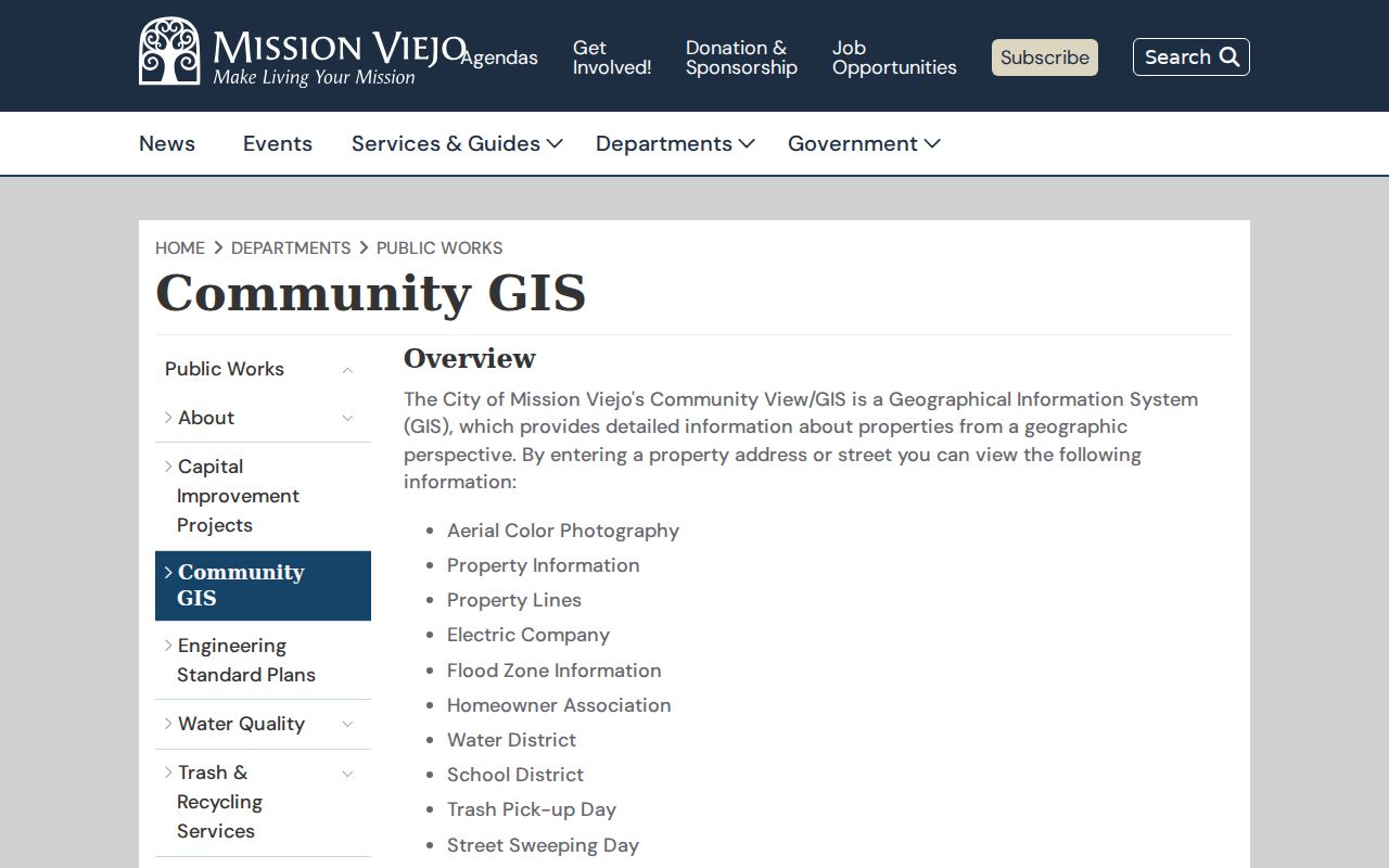
The viewer gives the street directory its first solid key: the parcel and APN, rather than a guessed resident name.
Orange County APN Search Fields
The public Orange County Assessor form is deliberately narrow. Its documented search field is an eight-digit APN, and the site says owner searching is prohibited and the owner name is omitted. That means an address search cannot be promised from the public form. Use the parcel number to inspect the roll concepts the portal supports.
| Field or control | Type | Street-search meaning |
|---|---|---|
| APN | Eight numeric digits | Required parcel key carried over from GIS or another lawful record. |
| Submit | Form control | Runs the parcel lookup; no public name browse is documented. |
| Roll context | Result concept | Annual roll or effective-date context, with tax-rate information where displayed. |
| Values | Result concepts | Land, improvement, total assessed value, exemptions, and net taxable value. |
Read the Orange County secured-property search instructions before relying on a result. The Assessor’s satellite inside Mission Viejo City Hall can answer fuller counter questions than the public web form, but the supported counter fields were not fully inventoried in the research.
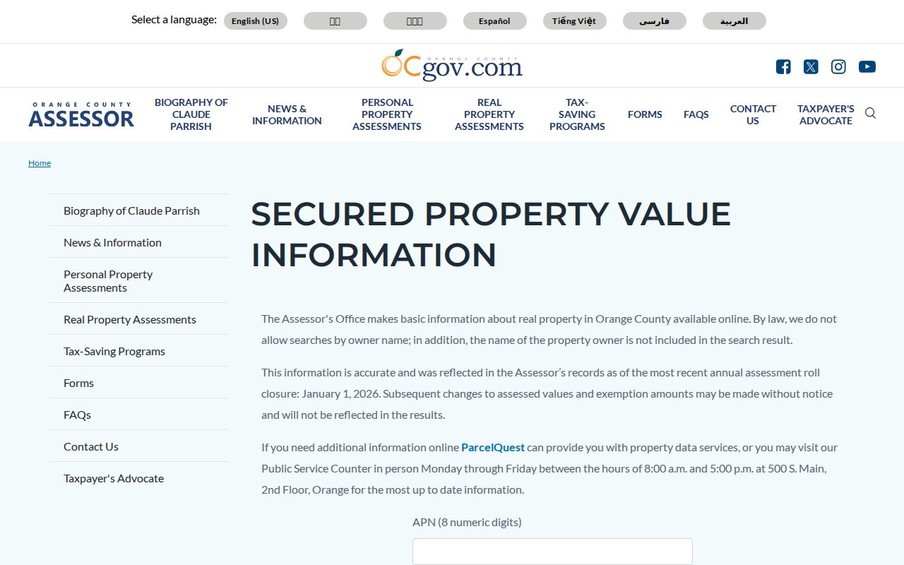
A street directory built from the APN is stronger than one built from a guessed owner name, yet it still says more about a parcel than about the people inside it.
Mission Viejo Records by Address
Address-keyed sources do not all describe the same relationship. GIS locates land. The roll describes assessment. A tax bill supplies a dated tax context. The recorder connects indexed parties to recorded instruments only after a name or reference is known. A permit describes work and roles at a site.
| Record set | Keeper | What it contributes | Access |
|---|---|---|---|
| Community GIS | Mission Viejo / OC Public Works | Parcel, APN, HOA, zoning, flood, districts, and service layers | Free advisory map |
| Assessed-value roll | Orange County Assessor | Annual land, improvement, total, exemption, and taxable-value context | APN form; owner omitted |
| Tax map or bill | Orange County Treasurer-Tax Collector | Tax context and parcel mapping, with published suppressions | Free search |
| Survey viewer | OC Public Works | Tract, parcel, annexation, survey, and legal-description clues | Free viewer |
| Recorder index and deed | Orange County Clerk-Recorder | Transfer parties, document type, date, and legal description after a copy is ordered | Free index; paid copy |
| EnerGov or CPRA file | Mission Viejo City Hall | Project scope, applicant roles, permits, and inspections | Portal or focused request |
The parcel number is the join key for most of the current chain. The street name is only a navigation clue. Postal formatting can vary, and a mailing address can belong to an absentee owner, trust, entity, or manager.
Mission Viejo Situs and Mailing Clues
Three address ideas need care. A situs address locates the parcel. A mailing address routes correspondence and may differ from the site. A legal description, tract, lot, and APN identify land even when a postal suffix or street format changes. The free Assessor result does not promise a public owner or mailing field, so do not infer one from a blank result.
- Parcel
- A mapped piece of land identified by an APN, with boundaries that may differ from a postal address.
- Situs address
- The location assigned to the parcel for site reference; it is not a list of every occupant.
- Plat
- A recorded map that shows lots, streets, easements, and legal relationships within a tract.
- Criss-cross directory
- A reverse address arrangement in a historical directory, if a local volume contains one; Mission Viejo’s exact runs need librarian confirmation.
The distinction matters when a street directory result is used to start a deed chain. Keep the address, APN, legal description, and recording date together.
Mission Viejo Permits by Address
Building Services’ Client Self Service portal can be searched by address or permit information. Address help says to search the street name or number and use Manual Location when a street is absent. The system offers Apply for Permits, Submit Plans, Revise Permits and Plans, Schedule Inspections, Pay Invoices or Fees, Check Application Status, a calendar, and a no-account fee estimator.
Online submissions have been required since September 2023. Files before September 7, 2023 are labeled Legacy Permits, and inspections have been online since July 1, 2025. Permit evidence may contain a permit number, site, owner or contractor role, applicant, scope, dates, plan and inspection activity, and use class. An applicant, contractor, or authorized agent is not automatically the homeowner or occupant.
Open the Mission Viejo Client Self Service instructions for the current address search route.
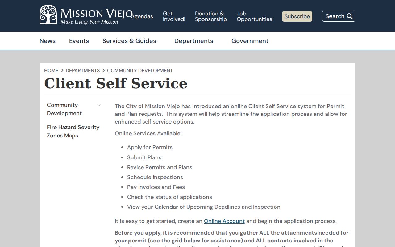
When anonymous portal fields do not answer a historic question, ask for existing permit cards, certificates of occupancy, and inspection histories by APN, address, and date range through a focused city request.
Tract Maps Explain Mission Viejo Streets
The OC Public Works survey viewer adds legal geography that a street directory page cannot get from a simple address search. Filters include city, document type, date range, parcel map, APN, and overlay or PDF. Document types include record of survey, parcel map, tract map, corner record, lot-line adjustment, topographic survey, tie book, and alignment note.
Results can include APN, legal description, parcel address or number, and road right-of-way dimensions. Layers cover annexations, parcels and maps, tentative maps, lot-line adjustments, corners, control and tie books, flood and field notes. Draw and Measure can check physical distance, while Street View supplies visual context. Neither tool identifies a household.
Mission Viejo’s planned-community history makes tract names useful search terms. Deane Homes dates to 1966, Granada and Mission Ridge to 1968, Madrid and Aliso Villa to 1971, and Barcelona to 1972. No official dated citywide street-renumbering event was located, so a failed old-address search should pivot to tract, builder, and legal-description terms rather than assume a renumbering.
See the OC Public Works survey map viewer for the document filters and parcel-map route.
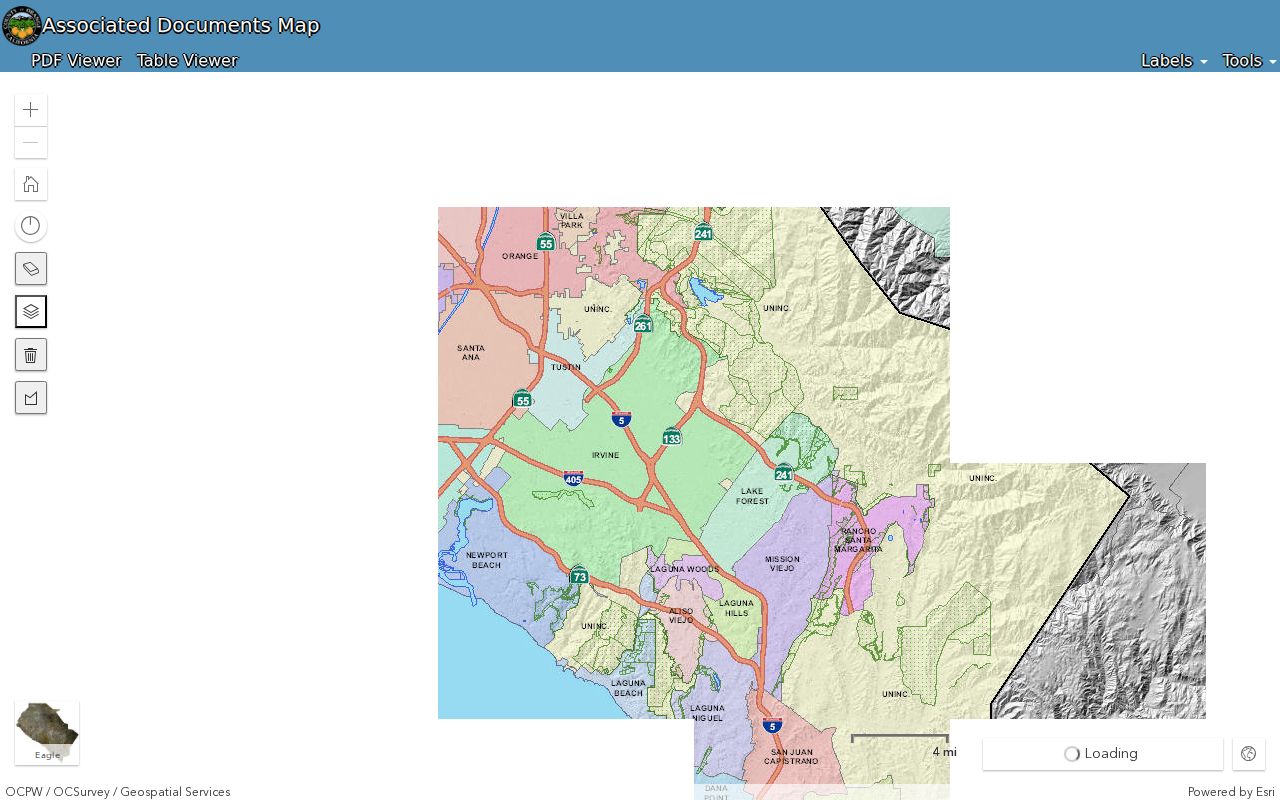
A survey viewer result can preserve a tract or legal-description clue when a modern street label does not.
Mission Viejo Deeds Along a Street
The recorder index does not search by address and does not show deed images on the web. After GIS supplies an APN, obtain a known titleholder or instrument reference through a lawful channel, then search that name as a grantee for the acquisition instrument. Read the ordered deed for grantor, grantee, vesting, legal description, recording date, return address, referenced instruments, and signatures.
Search the seller as an earlier grantee and repeat. Join each step on tract, lot, APN, legal description, date, and co-parties. A quitclaim conveys whatever interest the grantor has. A deed of trust is security, not the acquisition deed. A reconveyance releases that security. Trust transfers, former surnames, inheritance, and entity ownership can make a chain look like a move when it is not.
When the chain reaches Mission Viejo Company or a tract developer, shift to subdivision maps, county approvals, early brochures, and the development timeline. A deed chain answers ownership. It does not answer who rented a home or which household member was present.
Mission Viejo Reverse Sources
Historical street work may need the Mission Viejo Library’s local-history staff. The research did not locate an official publisher, year run, scan, or sample for a Mission Viejo reverse directory. Ask staff whether telephone books, Haines or criss-cross directories, tract brochures, clipping files, yearbooks, or uncataloged boxes cover the address and year.
The library has stronger verified material: Mission Viejo Reporter from 1966 through 1981, Saddleback Valley News from 1969 through 1989, more than 400 Heritage images, resident photographs covering roughly 50 years, oral histories, and video. Search the surname, initials, spouse or former surname, street without its suffix, tract, school, club, and event. Record the newspaper title, date, page, and image spelling because OCR can misread names.
When a historical directory entry needs modern confirmation, the Mission Viejo city-directory collections page keeps the library and archive routes separate from the current address chain.
Mission Viejo ZIP Labels on Streets
ZIP codes route mail; they do not define a city, HOA, school district, utility area, or parcel boundary. The city-proper geographic ZIPs documented in the research are 92691 and 92692. USPS output controls a complete delivery address. GIS and parcel jurisdiction control whether the land is inside Mission Viejo.
ZIP 92694 is associated with Ladera Ranch and Rancho Mission Viejo outside the city. ZIP 92690 remains an evidence gap because current PO-box or delivery status was not established. A postal label can therefore mislead a whole-street search. Verify the ZIP with USPS, then use the city and parcel layers for jurisdiction.
Practical rule. Use a ZIP to narrow mail geography. Use an APN, tract map, or city GIS layer to make a land or jurisdiction claim.
Mission Viejo Street Directory Limits
A street directory can locate parcels, show assessment concepts, trace recorded parties, and reveal dated project or historical evidence. It cannot promise a complete list of current residents. Renters, minors, household members, utility subscribers, confidential voters, and people who hold land through trusts or entities may not appear. DMV residential data is protected by the federal Driver’s Privacy Protection Act.
The Orange County voter street index is controlled. Qualified data can include selected registrant fields, but the application requires a lawful statutory purpose, signature, support, and payment. The city HOA layer establishes coverage, not membership. A permit applicant is not necessarily a resident. A parcel owner is not necessarily an occupant.
Lawful use. Use Mission Viejo street and address records for personal, lawful research, genealogy, property history, or civic review. Do not use a street directory to stalk, harass, intimidate, or harm anyone.